Logo Fundación Arquia
Logo

Centro de documentación FQ

Si aún no lo conoces te explicamos Qué es el Centro de Documentación FQ de Fundación Arquia

Contacto

Sede Oficinas

C/Barquillo, 6, 1º izda. 28004 Madrid

Sede Actividades Culturales

C/ Tutor, 16. 28008 Madrid

91 756 10 50

centrodocumentacion@arquia.es

Suscríbete

Suscríbete a nuestro boletín para estar al día de las últimas novedades y lanzamientos.

Al suscribirte, aceptas nuestra Política de Privacidad y das tu consentimiento para recibir actualizaciones de nuestra empresa.

© 2026 Centro de documentación FQ. Todos los derechos reservados.

Política de cookiesPolítica de privacidad
Centro de documentación FQ
InicioCatálogoCiclos
Logo

Centro de documentación FQ

InicioCatálogoCiclos
BAROZZI / VEIGA | Arquia - Centro de Documentación

Cargando artículo...

  1. Inicio
  2. /Catálogo
  3. /Artículos
  4. /BAROZZI / VEIGA
ArtículosBlog FQ

BAROZZI / VEIGA

Fundación Arquia

Desde Afasía Archzine

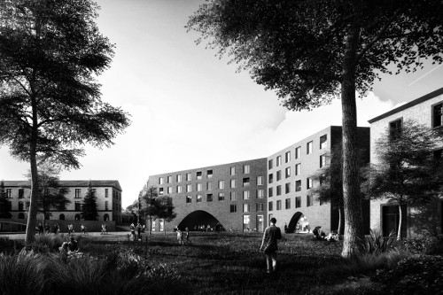
“Barozzi / Veiga has been awarded first prize in the international competition for the urban renewal of the old Montelungo and Colleoni barracks in Bergamo, Italy.
The functional program, with a total area of 30.000m2,includes a new urban park, university facilities, housing and commercial areas.(…)”

Fecha de publicación
11 de enero de 2016
Revista
Blog Fundación Arquia
Leer artículo en BlogFQ

También te puede interesar

Hostel CONII
RealizacionesPróxima

Hostel CONII

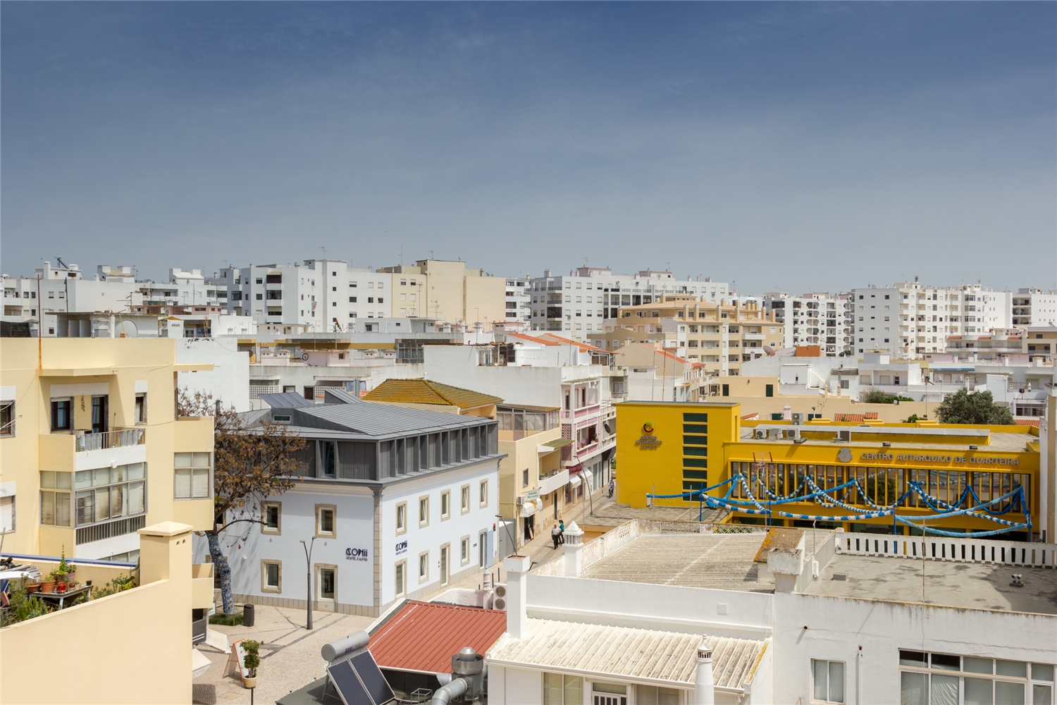
The intervention consists on the rehabilitation and extension of an old building dated from 1896. The building is inserted in the centre of the touristic city of Quarteira in Algarve. Originally the building was erected to dwell the workers from the fish canning industry that was expanding in the region in the last quarter of the XIX century.

Since that the building was kept in the same family and has survived to the touristic boom since the 1970's. The fast growth of the city has transformed the cityscape from an average of two floors to more than six floors in the last forty years. The building has a squared footprint and all facades free; two for the street and other two for a courtyard.

The strategy for the intervention was to keep the original support walls much as possible, and extend one extra floor in the roof. To archive this, was used a structural light steel framework system for part of the first floor and for new second floor.

The original space distribution revealed a simple frame organization along a corridor that crossed the building in half. This organization grid was kept in both original floors. The new floor turns the corridor perpendicular to its original position allowing the roof to lift and bring indirect light throughout two clerestory windows.

The new floor assumes a different finishing material which takes advantage of the structural framework with thinner elements to enhance the expression of the new windows.

The materials chosen reflect cost-efficient strategy where only three materials cover all finishing surfaces: The hydraulic floor tiles based on local colors (blues and yellows) and geometric patterns which covers all public areas and corridors; The wet areas finished with small tiles 10x10cm and an industrial wood panel OSB that is present in every space of the hostel, in furniture, flooring in bedrooms, the bunk beds, the kitchen and the wainscoting.

The program is separated by floors: In the ground floor the common areas; reception, common kitchen; lounge area and a bar. The first floor holds the mixed dorms with shared bathrooms; and in the second floor holds the double rooms with private bathrooms.

The blue exterior shutters announces the reception and the bar entry from the street.

Casa ALM
RealizacionesPróxima

Casa ALM

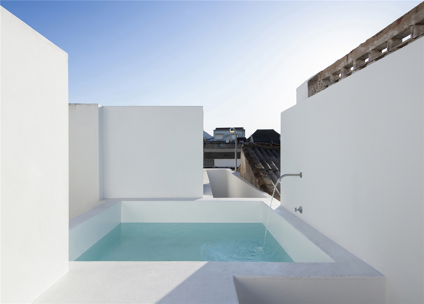
In a consolidated urban context of Tavira inner city a narrow lot with peculiar limits holds a old house with two floors and a roof attic. Over time the lot has changed its limits and new constructions were had blocking the natural light and ventilation. The house is located between two streets; the main access is made in the north side and a secondary access is made by the south throw an especially narrow corridor.

The depth of the lot suggest us a courtyard in the middle that allows natural light and ventilation to come inside. The courtyard works as the new center of the house in which an exterior three level promenade is initiated.

The exterior stair works has a connection element of the three levels promenade; starting in the ground floor courtyard which offers light and ventilation to the living room and the kitchen; following to the next level terrace to a raised water tank; the last level terrace offers a unique view cityscape view of Tavira and a roof attic.

The program is separated by levels: ground floor holds the social areas; entrance room; living room; kitchen and wc; the first floor holds the private areas with the two bedrooms and a bathroom. The roof attic a extra space is offered with direct relation with the terrace.

The materials used seek for the simplicity found in Algarve's vernacular architecture; in the ground floor the hydraulic mosaics cover all the interior spaces; the first floor solid wood for private areas and outside areas a grey polished concrete covers all the areas.

A red door spots the house in both elevations.

Vivienda + Estudio en St. Narcís
RealizacionesPróxima
,

Vivienda + Estudio en St. Narcís

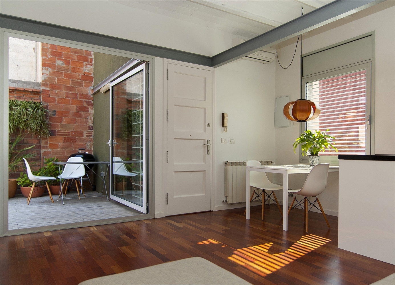
Rehabilitation of two terraced apartment buildings, located in the old town district of Sant Andreu. The intervention affects the ground floor, which has been used as a warehouse since 1900, and the second floor of the adjoining building. The project involves the rehabilitation of the buildings, providing them with the basic services and facilities.

In order to separate the ground floor from the first floor the staircase has been demolished, which has implied a structural reinforcement of the existing wooden beams. The remaining space is clear, turning the book shelves into screens that compartmentalize the interior.

On the second floor, the old walls have all been demolished, giving birth to an open, bright and airy space too.

The action surface is:

Studio of 38 m2 and 25 m2 patio.

Housing 32 m2 and 8 m2 terrace.

The stairscraper
RealizacionesPróxima

The stairscraper

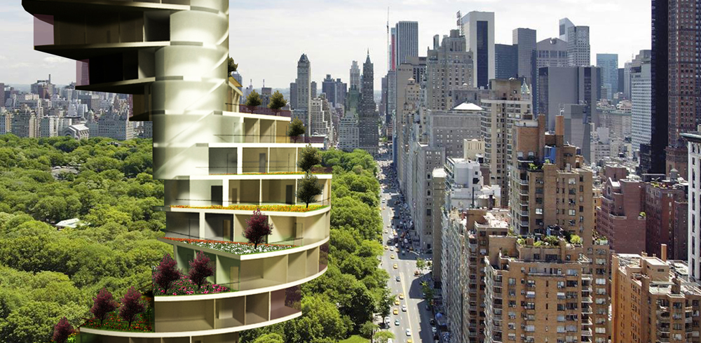
The time of urban planning related to the division of time and space in 8h 8h 8h (hours for a tot m2 per person;time for work tot m2 per person, time for leisure tot m2 per person, time for the rest tot m2 per person) through which have been conceived modern cities with their standards, has given way during last 15 years, to the possibility of a match the activities between residential, recreational, educational, productive ,carried out in a 24-time continuum in which it is difficult to differentiate spaces for their activities.

It's easy to say that in relation to the contemporary change in the space-time conditions also change the structure of society and the peculiarity of mobility in an urban environment, a social space, more and more defined by cultural diversity, and multiplicity of attitudes and activities.

The work space becomes for example an open space to many other possibilities and activated in a productive and at the same time ludic time not necessarily restricted in a specific area (space-time) of the day.

So the investigation of a "TOTAL HOUSING" can not be reduced to the study of some typologies of different and flexible as it can be but rather should be extended to the environment of complicity with the urban complexity and complicity. Interior and exterior, intimate and social space, landscape and architecture, the habitat cellula and "his" sensitive relationship with the natural and urban environment at the same time.

Questioning the relationship between quality and quantity is the essence of this radical research. THE Stair-scraper is a real provocation on the possibility of extending the housing to a Total Habitat sensitive to individual needs in a collective whole. So the passage from the private cottages (no spaces social bookmarking) to social cottages, maintaining individual and intimate space is evident.

THE STAIRScraper IS a superposition OF individual singular garden houses with the same characteristic of the horizontal sprawl but liberating the land and concentrating the uses and the energy. It is A social collective of individualities. The stair scraper is a complex 360 degree incorporate all kind of common facilities and public spaces at different levels maintaining the intimacy of the individual space with the same quality

Ravine Urbanism
RealizacionesPróxima
,

Ravine Urbanism

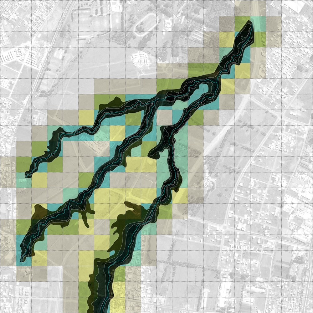
Ravine Urbanism es un proyecto de investigación sobre morfología urbana. Partiendo desde la microescala de la manzana urbana, indaga en la construcción de nuevas tipologías que favorezcan la densificación urbana y utilicen la condición extrema de los barrancos existentes como espacios recreativos y productivos para la ciudad. Por otra parte, desde la macroescala metropolitana, propone una nueva estrategia urbana para el año 2020 que formalice una expansión de la ciudad a modo de archipiélago, con centros urbanos densos y límites urbanos bien definidos. El proyecto exprime ciertas potencialidades de una ciudad que no ha sido estudiada críticamente a lo largo del último siglo, y propone una nueva vía de construcción del Quito contemporáneo: una ciudad que debe sustituir la tradición de la privatización del espacio urbano por una nueva inclusión de su geografía y una mayor densidad urbana.

The relationship between the city of Quito and its geography is interestingly dialectical. The exuberance of the geography surrounding the city has been fundamental in the construction of the visual identity for the city, yet this same geography has rarely been the raison d'être of the historic development of Quito, nor it is currently a point of reference towards its future growth or redevelopment at any scale. In order to overcome this critical rupture, the following research proceeds, at once, deductively and inductively. On the one hand, it analyses the ecology of the region at large scale to identify a particular physiographic feature, the ravine, that may serve to mediate between current urban expansion processes and the surrounding geographic configuration. On the other, it proposes a basic unit of city development –the urban block– as the datum to construct more comprehensive strategies of urban expansion. It is at the encounter of geography and history, at the physical junction of the ravine and the most paradigmatic urban blocks in the development of Quito, that a new morphological urban approach emerges as a response to today’s Metropolitan Quito most urgent challenges: geographical contextualization and urban densification.

Quito was founded on a valley of extreme topographical configuration. This valley –Humboldt called it “The Avenue of Volcanoes”– presents a rich network of ravines over which Quito has expanded into its current metropolitan dimension. These ravines are ecologically crucial, for they compose an intricate system of ecological corridors that connect the western valleys of the Andes with the Amazon watershed to the east, crossing a region that sustains one of the highest levels of biodiversity in the world. With every urban expansion, the courses of the ravines have been filled under the urban footprint and, therefore, the ecology of the region has been seriously disturbed. In parallel, Quito’s growth has been largely shaped by private sector’s interests in capital control and accumulation, and the result is a disjointed urban fabric of very low density and high compartmentalization with few and poor open public spaces. Therefore, the social opportunities that ravines offer as urban recreational areas and spaces of cultural identification have also been limited. Under these circumstances, Ravine Urbanism focuses on the district of Quitumbe, in the less developed, poorer and more informal southern half of the city. Quitumbe presents, still today, a series of superficial ravines that serve to test new ravine-block configurations to inform a more coherent strategy for urban development under extreme geographic conditions. This typological exploration promotes, on the one hand, the geography of ravines as an important contextual feature in the construction of a new urban identity while, on the other, encourages a denser urban fabric in the quest of a more diverse social experience and higher economic performance. Understanding the inductive logic of the block as the basic unit in the development of open urban strategies, the proposal for Quitumbe negotiates the geography of the ravines through a gradient of block normalization, that departs from a consistent and mostly open buffer zone along the ravine courses, towards areas of less complex topography where higher densities will conform new urban centralities. This gradient of normalization is presented as a tactic to be exported to the expansive inertia of the city at large, in the shape of a series of dense urban centers surrounded by largely open ecological reserves. Ravine Urbanism claims, ultimately, geography as a guide for n exploration of new urban morphologies that promote at once cultural identity and ecological performance.


Proyecto de Intervención Urbana "Take Park"
RealizacionesPróxima
,,

Proyecto de Intervención Urbana "Take Park"

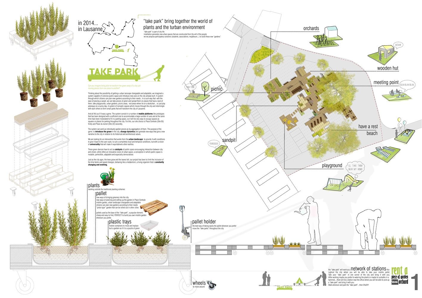
Can you imagine being able to transform the green areas of a city just moving pieces from one place to another?

Thinking about the possibility of getting a urban lanscape changeable and adaptable, we imagined a system capable of colonize public space and introduce new uses on the city already built. A system through which citizens can plan new gardens according to their needs ; in a such way that with the ease of placing a carpet, we can take pieces of green and spread them on places that have a lack of them, take playgrounds, urban gardens, picnic areas, rest areas where lie on a deckchair… or just play petanque on a sunny day. A system of nomadic spaces which moves through the city and intermingle with each others to form small parks that will transform the city of Lausanne.

And all this as if it was a game. The system consist in a number of mobile platforms like prototypes that has been designed with a sufficient size to accommodate a large number of uses and at the same time have been modulated to fit in a parking space, so it will be very easy to occupy spaces as squares or places for parking throughout the city. For this, our site choice is Place Centrale (Site 05) firstly and Place du tunnel (Site 22) secondly.

The system can work as individually garden pieces as by aggregation of them. The purpose of the game: to introduce the green in the city, change dynamics and generate new ways that give a new narrative to the city in relation to its historical and architectural values.

We are looking for an intervention that works from the urban landscape to provide it with conditions to give it back to the user scale, to suit a completely local and temporal conditions, but with a vision of universality that will make it exportablevto other realities.

These green devices have to act as catalysts of public space encouraging interaction between city and citizen, while offers an innovative vision of urban space, a conception in which public space is mutable, perfectible, adaptable and especially democratizes

Just as the city ages, the trees grow and the leaves fall, our project has been to limit the inclusion of the time factor and speed changes, behaving like a metabolism, a living organism that is constantly changing and evolving.

Con la colaboración de:

Xavier Bel y Ignaci Anguera

más información